Beginning
In 1263, a team of Cabotton scholars aboard an airship, which was blown off-course by a storm near the Mid-Westerlies, took photographs of the mountain peaks of Northeast Ancondria, thus becoming the first modern-day Circlarians to make records of Ancondria's existence available for study by Greater Circlarian public institutions. Such photographs were mistaken for those of other parts of the Magnumarian Ocean, initially; but Cabotton professors studying the images in 1268 made the realization that such were of significant pieces of uncharted territory. Thus began the Era of Ancondrian Exploration.
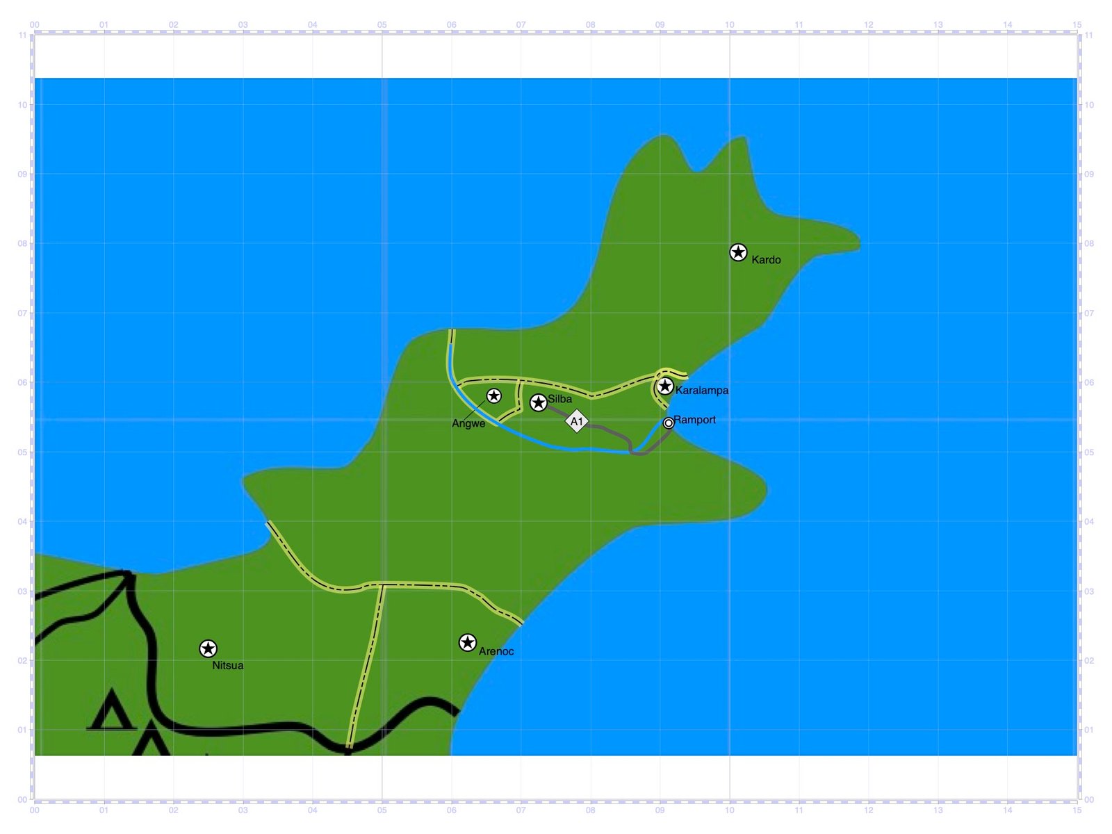
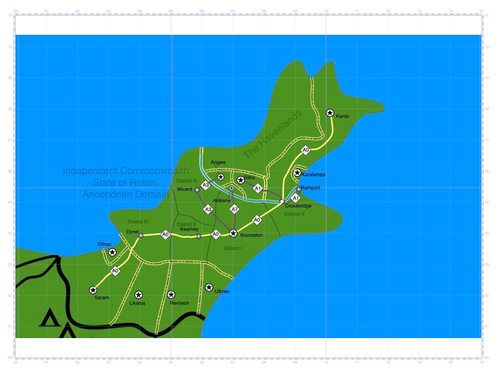
Throughout the 1270s, numerous bases and settlements sprung up near and throughout Northeast Ancondria. Initially, most were "peg-and-gravel" airship landing fields, each of which included a gravel landing pad upon which the airships landed via landing hooks planting into the ground on-site. Such places were accommodated by tents, trailers, or pavilions dedicated to essential services. The first bases established were Bay Landing Base (present-day Minlon), Base One (present-day Silba), Base Two (present-day Wicard), Base Three (present-day Dynel), Base Four (present-day Kearney), Base Five (present-day East Providence), and Aeris Base (near the ruins of Edom). Over the years, other nations would establish similar bases in various other locations. In 1280, Bay Landing Base was upgraded to provide landing hook rails for incoming airships, similar to those in regular usage in the Greater Circlarian Realm. This was followed by a similar upgrade at Aeris in 1287, Silba in 1297, and, in 1300, Wicard, Dynel, Kearney, and Kronoston (formerly Base Five).
Each location was linked also by land via large gravel paths servicing large vehicles known as All-Terrain Rovers, which were designed specifically for use in Ancondria.
Silba was, until 1272, referred to by its ancient name: Tonguakinstaktu. In the early 1100s, a group of families from the Greater Circlarian Realm landed in the region; though they never returned to their place of origin, thus the sight of Ancondria was never reported back to the Greater Circlarian Realm during this time. After landing, they settled with the local native Ancondrian communities and married into some of their prominent families, thus establishing House Maderon. With combined wealth from its member-families and technological expertise brought from the Circlarian side, House Maderon led Tonguakinstaktu into becoming the first modern city of Ancondria. Shortly after modern Circlarians began exploring the region between the late 1260s and early 1270s, they made contact with House Maderon. In 1272, they established Tonguakinstaktu as the city of Silba, officially with a mailing zip code. And by 1297, Base One was developed into Silba Airfield.
Before long, there emerged issues as settler traveling demands began to increase. House Maderon had been addressing the issue with minor upgrades in local places, funded by proceeds from its lucrative lightfire economy. And they had planned to partner with Karalampa (present-day Malfua) to establish joint projects accordingly. However, by the late 1270s, Karalampa had nearly declared bankruptcy, only to avoid the crisis with the selling of a large portion of its territory back to House Maderon, who in turn was eager to sell it off again. The Federal Estates of Retun purchased this land, thus establishing Bay Landing to begin with. And with this came an opportunity to help fund the development of Bay Landing into a major seaport. Shortly thereafter, Bay Landing was renamed to Ramport.
Establishment of Ramport
On 01 September 1281, Ramport was officially established, initially to service businesses trading in the industry of lightfire, throughout Ancondria and the Greater Circlarian Realm. Ramport was a fairly small location at the time but would grow exponentially thanks to its desirable weather and surrounding fertile farmland.
Ramport was divided into three districts: the Sea Level District, Lower Ramport, and Upper Ramport. The Sea Level District was home to Five Super-piers, which were arranged in an outward fan formation into a deep, nearly-enclosed harbor. Each Super-pier had its own zip code and contained an indoor town with a Lower Trade Floor, Upper Commerce Floor, and Top Balcony for tourists. Lower Ramport was 400 feet above sea level, and was, in general, categorized by business and tourist street blocks in its North and city blocks dedicated to manufacturing warehouses in its South. Upper Ramport was 600 feet above sea level, and was home to the Government Seat of the City as well as numerous residential districts.
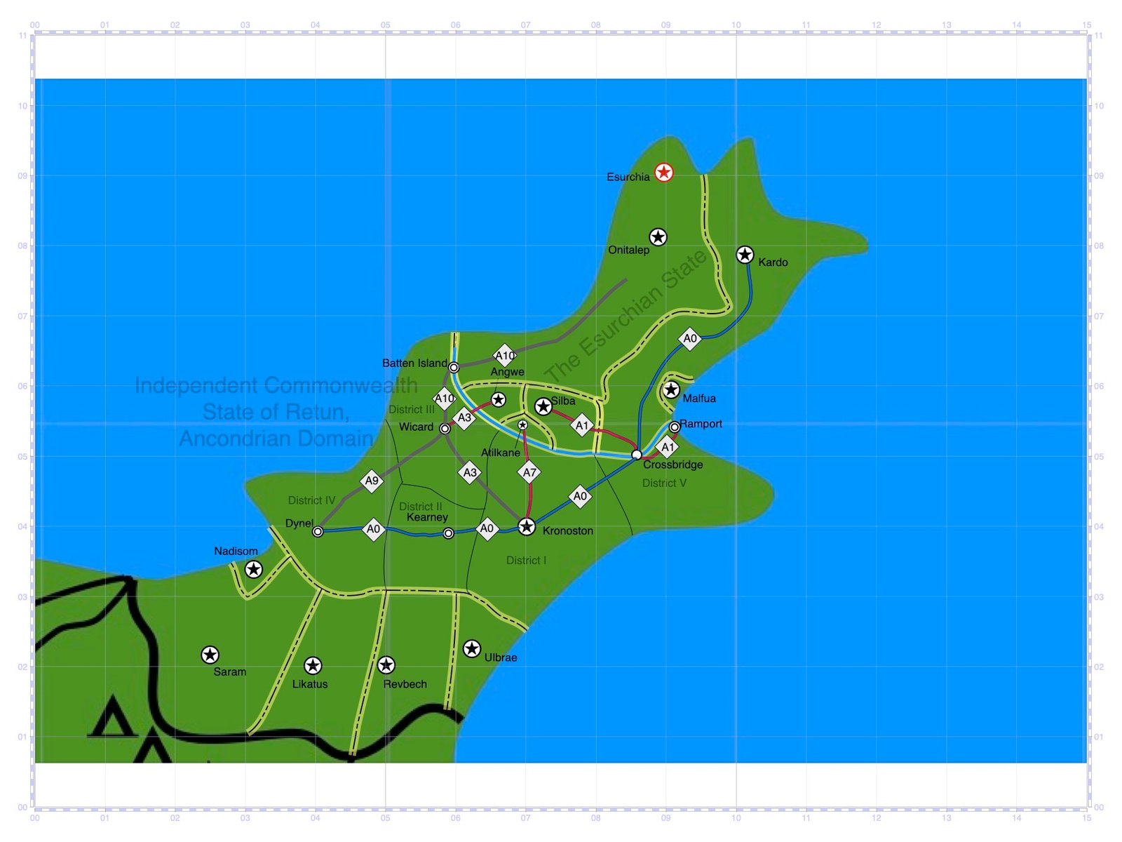
The Super-piers would service both cargo and passenger ships while Ramport Airfield would service a larger portion of overseas air travel. The Terminal of Mass Transit was established for the All-Terrain Rovers and would serve as an endpoint for a major rover track running from Ramport to Silba. In 1286, the city of Crossbridge was established, home to a crossroads between the Ramport-Silba rover track as well as rover tracks to Wicard, Dynel, Kearny, and Kronoston.
House Maderon and Silver Lines
Throughout the 1280s, settler traffic demands increased dramatically. Airfields began filling to capacity while the rover system, tasked primarily with transporting passengers and heavy cargo, began to struggle as well. By the 1290s, these rovers were increasingly deemed too slow and too lacking in capacity. In 1284, All-Terrain Compound Vehicles, or ACTVs, came into commercial use with an average frame more than twice as wide and twice as long as that of a traditional rover, increasing potential passenger and cargo volume. Moreover, these frames were designed to install and uninstall any combination of passenger and cargo "pods," while shock absorbers and enhanced thrust made these vehicles capable of traveling at higher speeds.
Yet this breakthrough at the time was not sufficient to address the traffic volume issues posed by the settler population increase; thus, House Maderon and the Retunian cable rail company, Silver Lines, came to an agreement, in 1287, to begin constructing a high-speed cable rail network.
The majority of planning and zoning for what would become known as the Great Ancondrian Cable Train Network Project took place between 1287 and 1288. Between 1289 and 1290, the cable rail towers were erected with plans to string the actual cable the following year. However, in 1290, the Hasphitat Trade Stone Market crashed, prompting Silver Lines to lay off workers and furlough the project. Over the years that followed, Ancondrian cosmopolitans purchased some properties upon which the towers stood and converted those towers to be sold as scrap metal. Silver Lines pushed and succeeded to attain land around two cable rail towers near Ramport to be preserved.
Lorry System: The Establishment of the Ancondrian Domain of Retun
In 1292, House Maderon commissioned the Retunian lightfire company, West Horizon, to construct a paved track to run between Ramport and Silba, over which newer-generation ATCVs, these known informally as "lorries," were slated to commercially reach cruising speeds of 125 miles per hour. The overall design of each lorry vehicle was basically one traveling pod atop two thruster engines, giving the vehicle a rough triangular prism shape. A typical passenger pod contained two levels: the lower level containing a cafe or dining area as well as a lounge and atrium, and the upper level containing passenger seating sections over an outlay similar to that of cable rail passenger cabins. These new vehicles were officially referred to as Long-Distance Compound Vehicles, or LDCVs, which, like their predecessors, were capable of carrying interchangeable passenger and freight pods. Between 1293 and 1294, West Horizon constructed what would become Route A1, a four-lane concrete lorry track, lined on each side by two conventional car lanes, to connect the cities of Ramport and Silba. Not long after its official opening to the public in January 1295 was Route A1 determined to be a resounding success.
Jon Waltmann, elected the year before, became the Retunian Prime Minister in January 1297, and vowed to help Silver Lines re-initiate the Great Ancondrian Cable Train Network Project. However, such an agenda proved difficult owing to most of the land originally dedicated to the cable rail infrastructure being taken up by Route A1 and the "insane" land development leaving Silver Lines struggling to obtain zoning clearances.
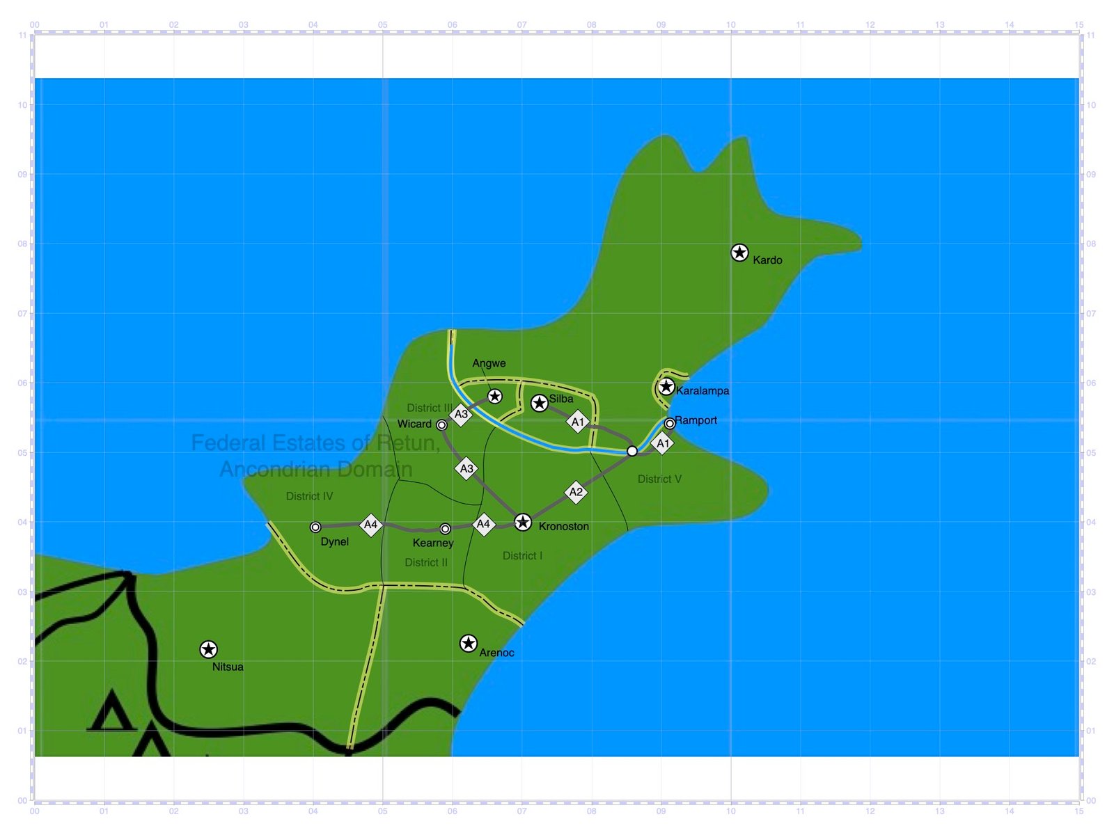
Then the Retunian economy collapsed in 1301, forcing Silver Lines to declare bankruptcy and the entire cable rail industry in Middle Remikra to collapse. Thus, the Great Ancondrian Cable Train Network Project was abandoned entirely. Prime Minister Waltmann, in the wake of this, diverted all efforts toward expanding the lorry system, which presented itself as a permanent solution. After the establishment of the Ancondrian Domain of Retun in 1304 came the constructions of Route A2 from Ramport to Kronoston, Route A3 passing through Wicard in running from Kronoston to Angwe, and Route A4 passing through Kearney in running from Kronoston to Dynel.

Lorry System: Expansions
The 1309 Revolution in Middle Remikra paved the way for a short-term economic boom which saw an increase in population and trade throughout Northeast Ancondria. In 1310, in response to increasing demand, the new Prime Minister, Holz Finzi, signed a package to expand the lorry network. Route A5, running from Dynel to Saram, was built in 1312.
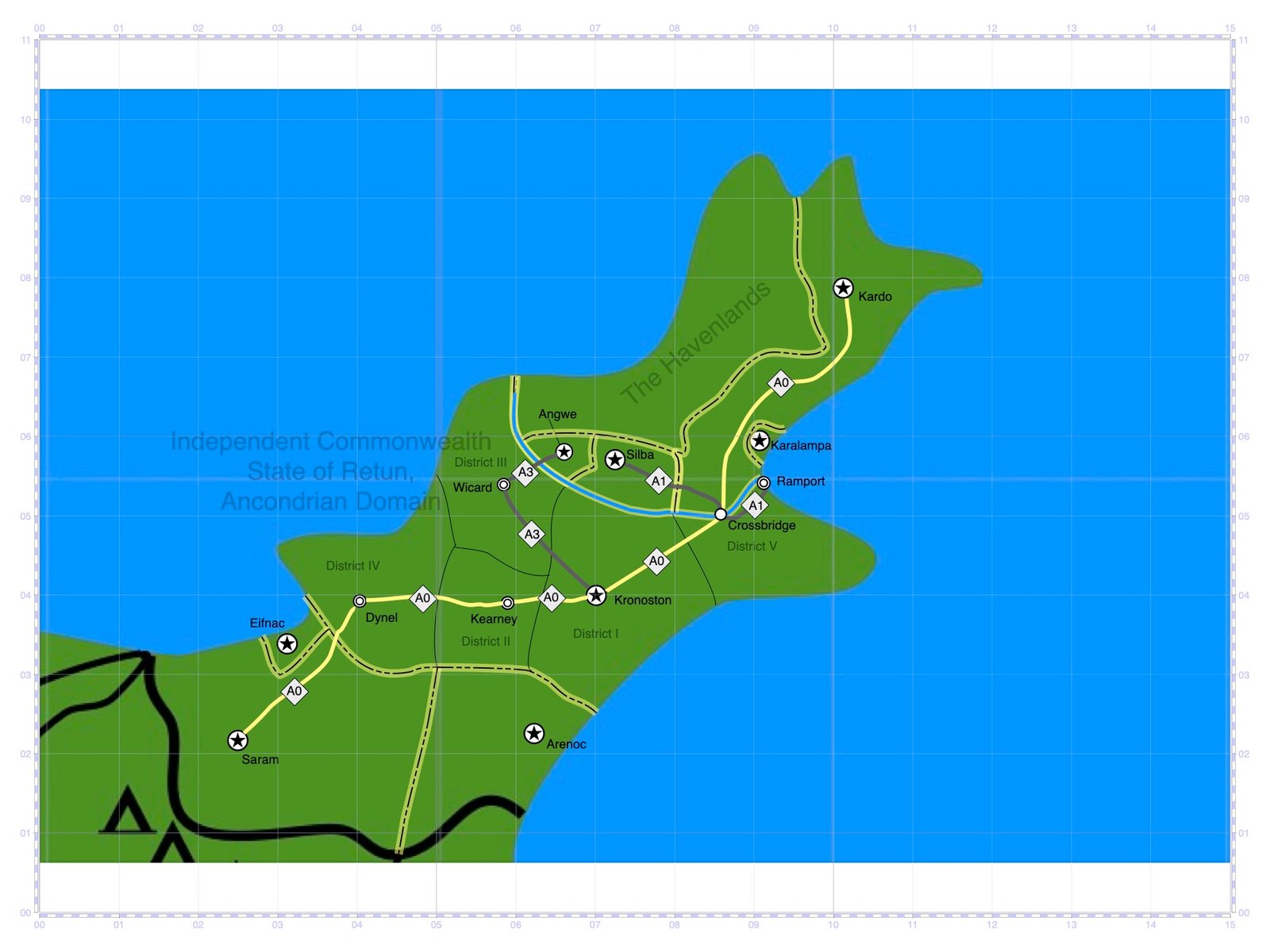
In 1317, after international negotiations, the lorry track running from Saram through Dynel, Kearney, Kronoston, and Crossbridge, was extended to Kardo proper and named Route A0. This new Route would be referred to officially as the Great Ancondrian Freeway.
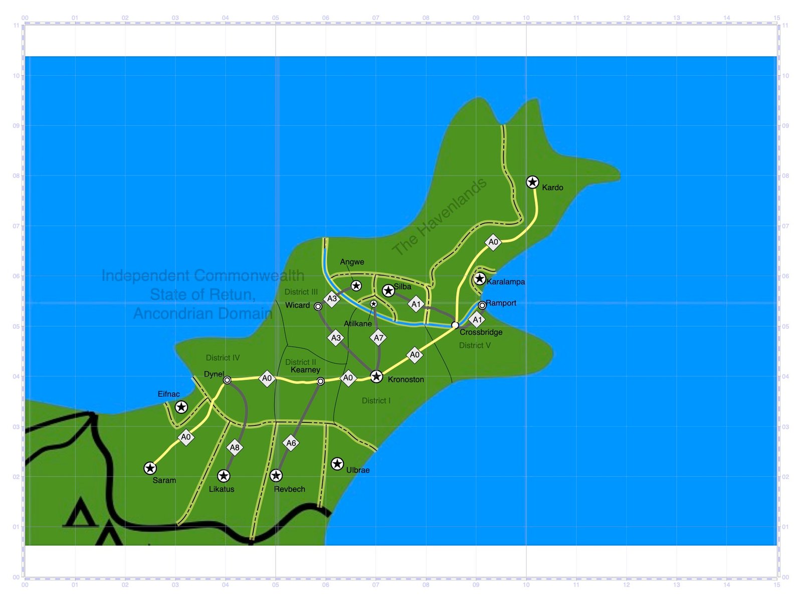
Between 1322 and 1323, gyroplanes, replacing airships as the primary way of air travel, began proving competitive to the lorry industry. Nevertheless, by 1329, the lorry network expanded to include the connection of Kearney and Revbech via Route A6, the connection of Kronoston and Atilkane via Route A7, and the connection of Dynel and Likatus via Route A8.
Lorry System: Tolls and Demolitions
As the lorry system continued to expand, many Ancondrian States outside of the Retunian Commonwealth began electing leaders who increasingly condemned the Commonwealth, as well as West Horizon, for having too much of a monopoly over Northeast Ancondria and its markets.


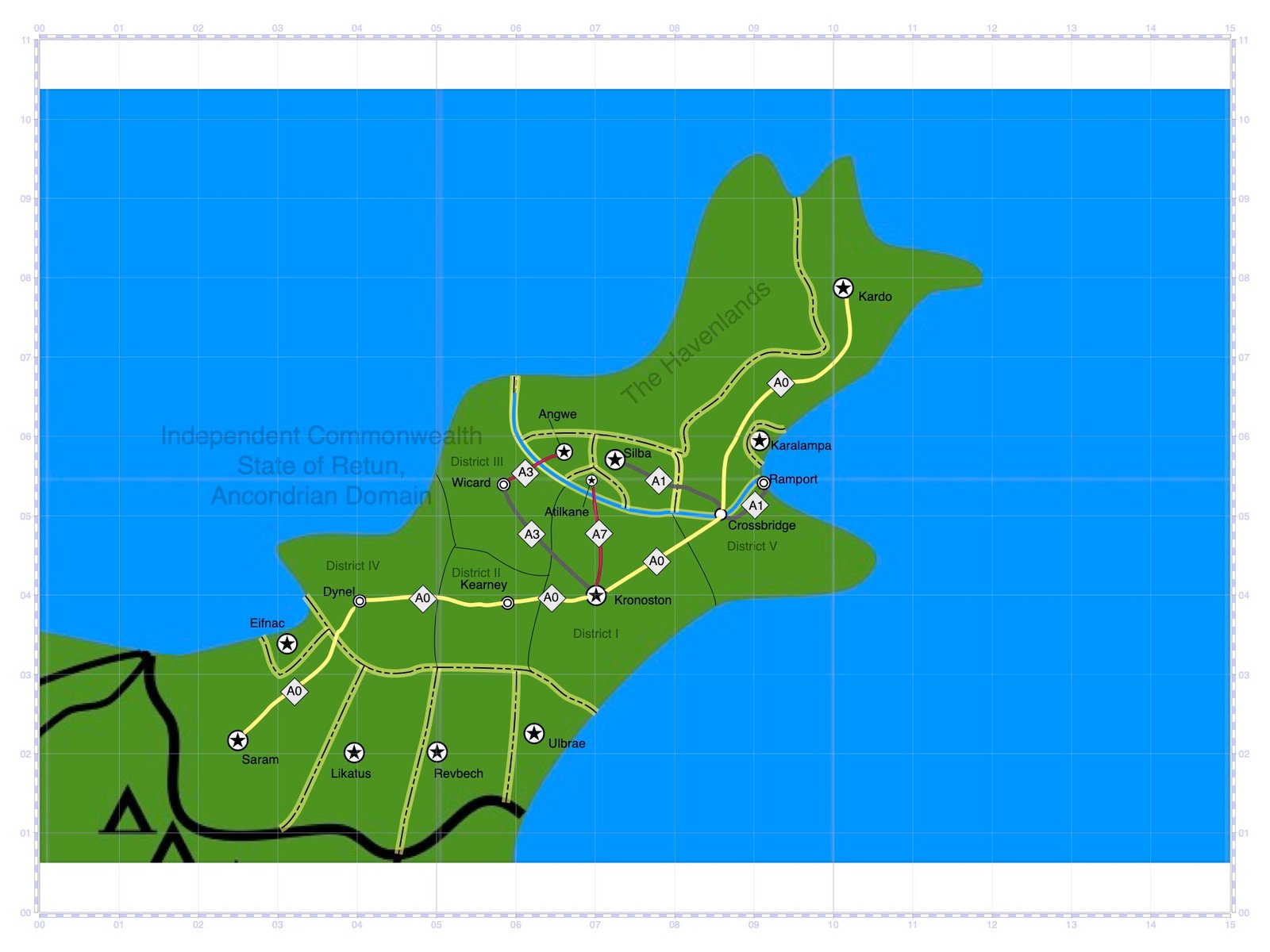
Conflicts of interest arose between the Ancondrian State of Likatus and the Retunian Commonwealth over the subject of deep-trade. In 1331, such conflicts culminated in Finzi ordering a bombing drill against dwellings home to Likatian deep-trade "squatters" near Dynel. Congress of Circlaria considered this decision to not be an act of war due to Finzi having ordered an evacuation of the housing zone and anticipating that the structures would be empty. Nevertheless, in March 1331, the Ancondrian State of Likatus retaliated with the construction of a toll gate and imposition of entry tolls over their side of Route A8. They would also imposed tolls on all other forms of land, sea, and air traffic from the Retunian Commonwealth. In June, Finzi called for negotiations with Likatus to lift or reduce the tolls, to which Likatian leaders responded with a call for the Retunian Commonwealth to accept conditional terms favoring the "squatters." The Retunian Commonwealth refused to consider such terms to which Likatus responded with toll increases. In September, the Retunian Commonwealth responded with the demolition of its side of Route A8. That November, Likatus demolished its side of the Route. In 1332, Likatus convinced the Ancondrian State of Revbech to demolish its side of Route A6 and exact traffic entry tolls on land, sea, and air vessels from the Retunian Commonwealth similar to what Likatus did in 1331. This was followed by the imposition of lorry tolls by Atilkane on its side of Route A7 in 1333, Angwe over Route A3 in 1334, and Silba over Route A1 in 1340.

In 1343, the Ancondrian State of Kardo imposed tolls on its side of the Great Ancondrian Freeway, causing a great deal of controversy. Many passengers and businesses would turn to gyroplanes as a way of travel.
West Horizon and the Retunian Commonwealth attempted negotiations to rectify the situation, most to no avail. Furthermore, in 1346, the Ancondrian State of Nadisom rejected a Retunian deep-trade proposal that would have included Nadisom being included in the lorry network. That same year, Atilkane rejected a similar deep-trade proposal and increased its tolls on Route A7.

Lorry System: 1350 to 1375
In 1350, after a great deal of negotiations, Kardo agreed to decommission its toll gates and allow free passage of lorry traffic, albeit to bill their tolls afterward. To this Kardo agreed after the the promise was made by the Retunian Commonwealth to recognize the renaming of the Great Ancondrian Freeway to the Great Ancondrian Thruway.
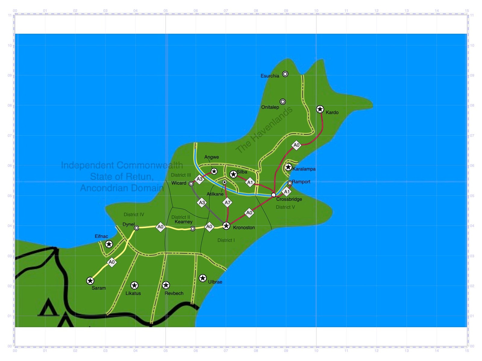
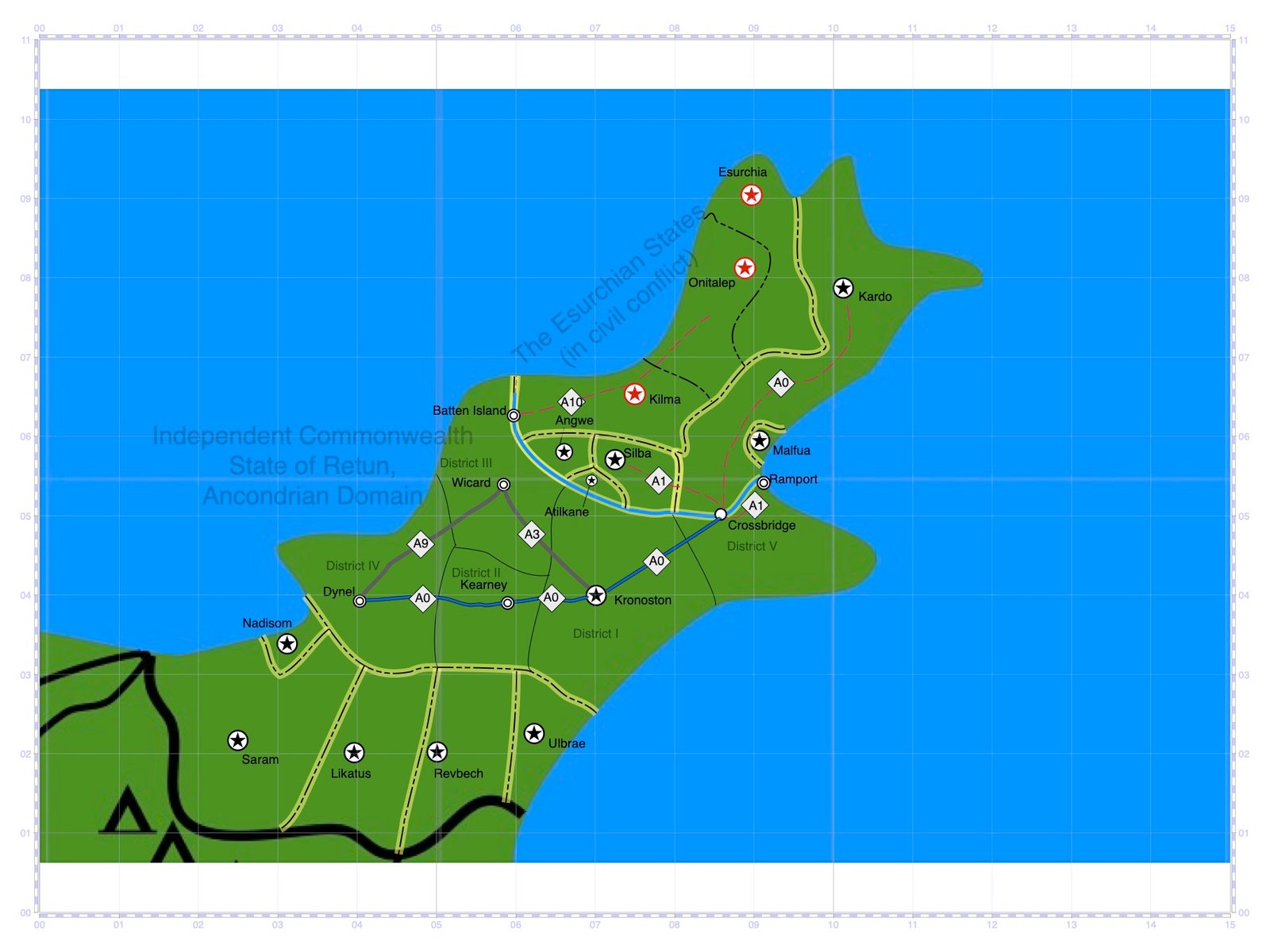
In 1359, the Esurchians, having recently entered Ancondrian markets and politics, touched upon a long-standing popular sentiment in the Retunian Domain to build a lorry route between Wicard and Dynel. The provision added by the Esurchians stood to have such a route then extend past Wicard and into the Havenlands (which would fall under rule of the Esurchian State in the years to come). Such a route would be named the New Great Ancondrian Freeway. And as part of this measure, the Retunian Commonwealth sold the part of the original Ancondrian Thruway in the Ancondrian State of Saram to the Saramian government, who in turn demolished this section a short time later after citing costs.
Meanwhile, by 1360, the lorry route connecting Dynel to Wicard was completed while construction on the extensions was well underway, built up to within 100 miles of the city of Onitalep. The initiative here was interrupted by sporadic attacks carried out in the Havenlands by factions opposed to the emerging Esurchian Regime. Despite such interruptions, construction would continue until the route came within 50 miles of Onitalep. The original plan was to pass through the city to be serviced by a terminal, and extend to its endpoint in the city of Esurchia proper. However, in the summer of 1360, political fallout from the Esurchian Coup, which propelled the city of Esurchia to becoming a political dominance over all of the Havenlands, led the original plan for the extension to being scrapped in favor of another plan to have the route bypass Onitalep and go directly to Esurchia. This was not agreed upon by all Retunian and West Horizon leaders, however, and thus conflicts of interest erupted between them and the Esurchians. This led to a breakdown in the project initiative and construction eventually being brought to a standstill in 1361.
In 1362, the Retunian Commonwealth, after persistent conflicts of interest, terminated most relations with the Esurchian State and imposed sanctions. After the confrontation between the Esurchian Scouts and the Retunian Civil Guard on Batten Island on 16 March 1362, the Retunians demolished the Batten Island Bridge, thus cutting the lorry route on the Retunian side off from that on the Esurchian side. The Esurchians, afterward, attempted to restore and expand their portion of the unfinished lorry route without Retunian support; however, such efforts stalled due to widespread corruption and incompetence. Meanwhile, Esurchian Scout forces began intercepting lorries along the Great Ancondrian Thruway between Crossbridge and Kardo in an attempt to collect illegitimate debts through forceful means.

Tensions between the Retunian Commonwealth and the Esurchian State escalated into the Esurchian War, which began in March 1365. That November, as they laid siege to Kardo proper, Esurchian forces destroyed the last 15 miles of the Great Ancondrian Thruway, forcing the entire section of Thruway between Kardo and Crossbridge to close. In January 1366, Route A1 would be put out of commission by Esurchian air raids. Talks of restoration began a short time later but would be delayed due to further attacks by the Esurchians. And in April 1367, Esurchian attacks would put Routes A7 and A3.

It was not until the signing of a cease-fire agreement by the Esurchians in 1368, thus ending the Esurchian War, that the opportunity came to rebuild the heavily-damaged lorry route network.
Lorry System: Decommissions and Closures
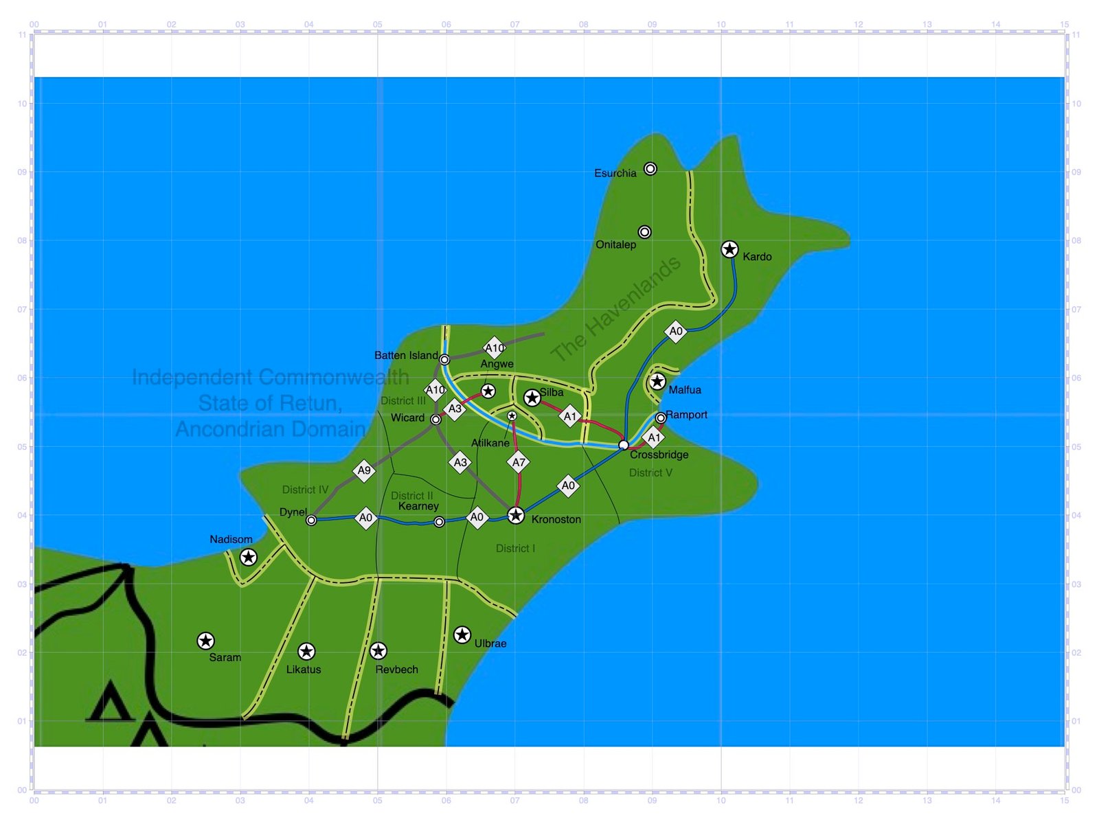
In the beginning of 1369, Route A3, after extensive repairs, opened to the public again. However, this route, along with Route A9 and the part of the Great Ancondrian Thruway running from Crossbridge and Dynel were the only portions of the lorry transit network in operation. That summer, West Horizon sent representatives to Ramport to call a Conference with other business and government leaders in order to form a plan to rebuild the parts of the lorry network damaged during the Esurchian War. However, West Horizon, by this point, had been exposed as a major player behind major unethical business arrangements, primarily those with the Esurchians during the Esurchian War as well as states and businesses on both sides of the ongoing Great Ancondrian War (taking place in the Great Ancondrian River Basin). Upon news reaching the public of the Conference to take place, the people of Ramport staged a general strike, eventually prompting West Horizon and other involved business and government leaders to cancel the Conference.
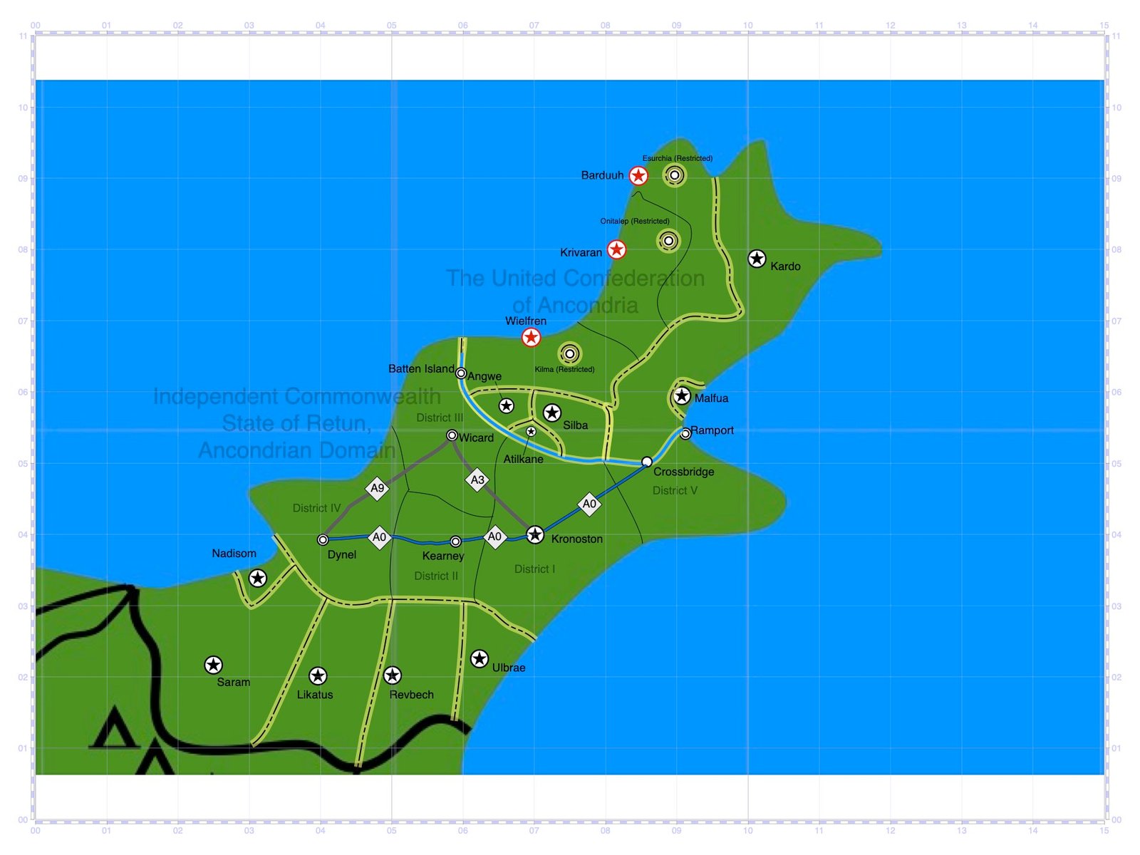

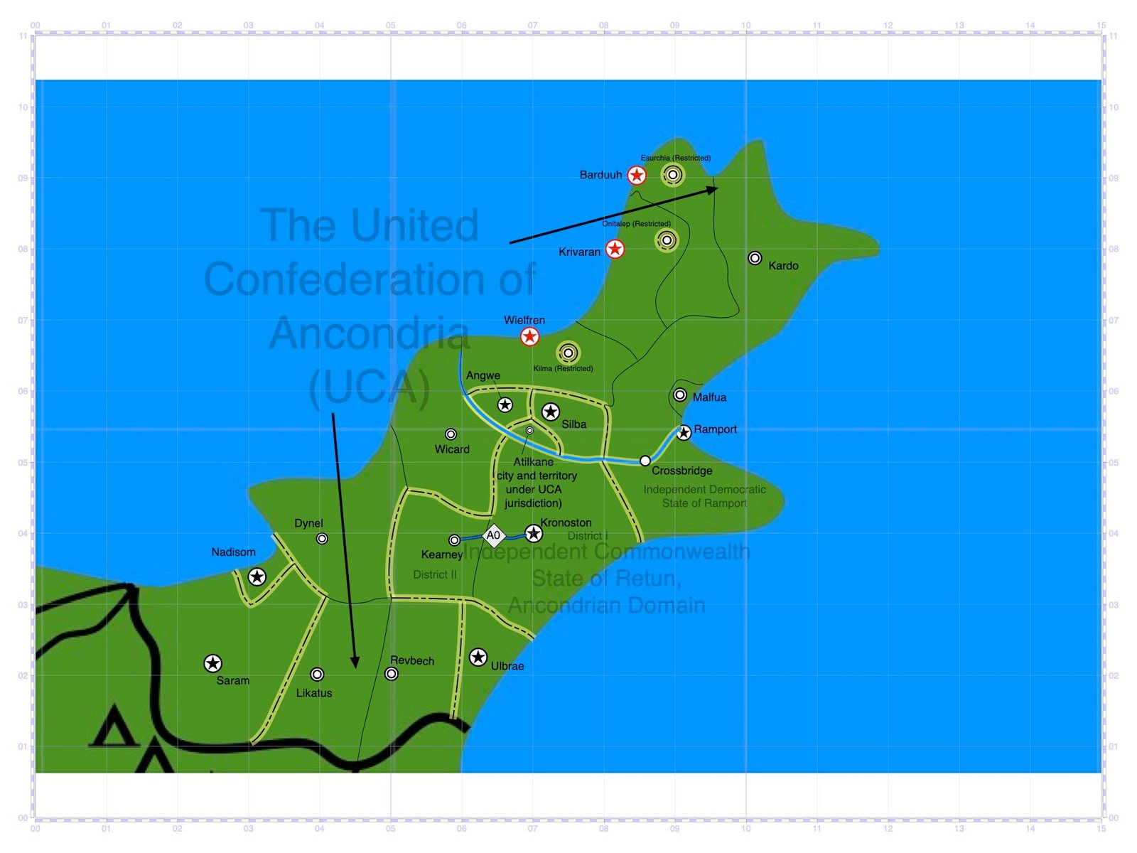
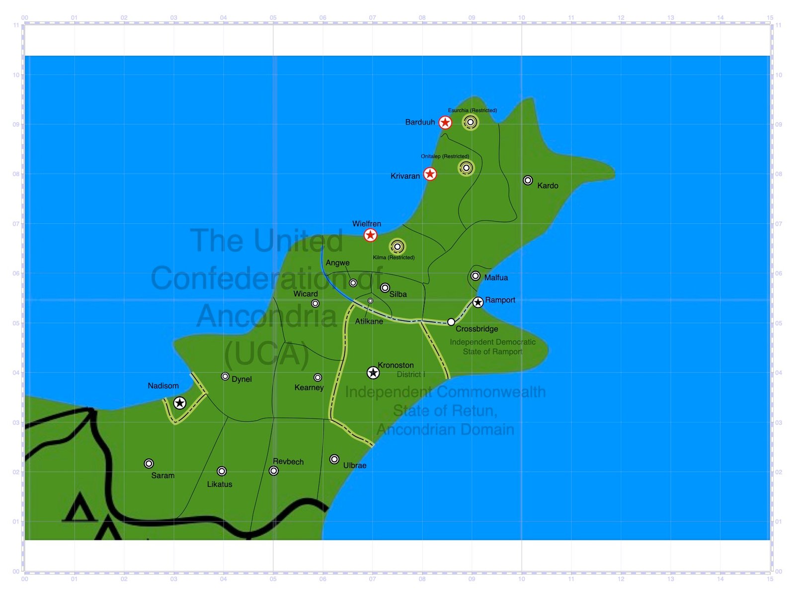
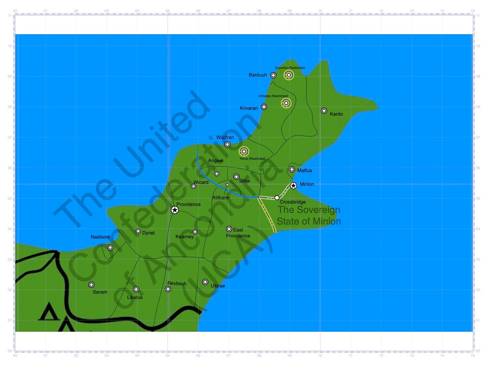
In December 1370, the territories of the Havenlands formed the United Confederation of Ancondria. With this political movement came a call to not only bring an end to the lorry transit industry, but to end all Retunian influence in the Northeast Ancondrian region. In 1371, the District of Ramport gained independence from the Retunian Commonwealth, thus becoming the Independent Democratic State of Ramport (later the Sovereign State of Minlon in 1376). Shortly after Ramport's independence movement, the portion of the Great Ancondrian Thruway between Kronoston and Crossbridge was decommissioned. Two years later, the United Confederation of Ancondria would acquire, via popular referendum, the Ancondrian States of Kardo, Malfua, Likatus, Atilkane, and Revbech, as well as the Retunian Districts of Wicard and Dynel; thus Routes A9 and A3, as well as the portion of the Great Ancondrian Thruway between Kearney and Dynel, would be decommissioned. In 1375, the Retunian District of Kearney as well as the Ancondrian States of Saram, Ulbrae, Angwe, and Silba joined the Ancondrian Confederation, leading to the decommission of the last remaining lorry route: the portion of the former Great Ancondrian Thruway between Kronoston and Kearney. In the year that followed, the last remaining Retunian jurisdiction, in which Kronoston stood, would be handed over to the Ancondrian Confederation. Kronoston would later be renamed East Providence.
Present
Presently, there remain virtually no traces of the lorry transit system having been in existence. Most transit is done through gyroplanes and flying POD vehicles; though occasional hobbyists enjoy using bicycles and non-flying automobiles along the roadways.